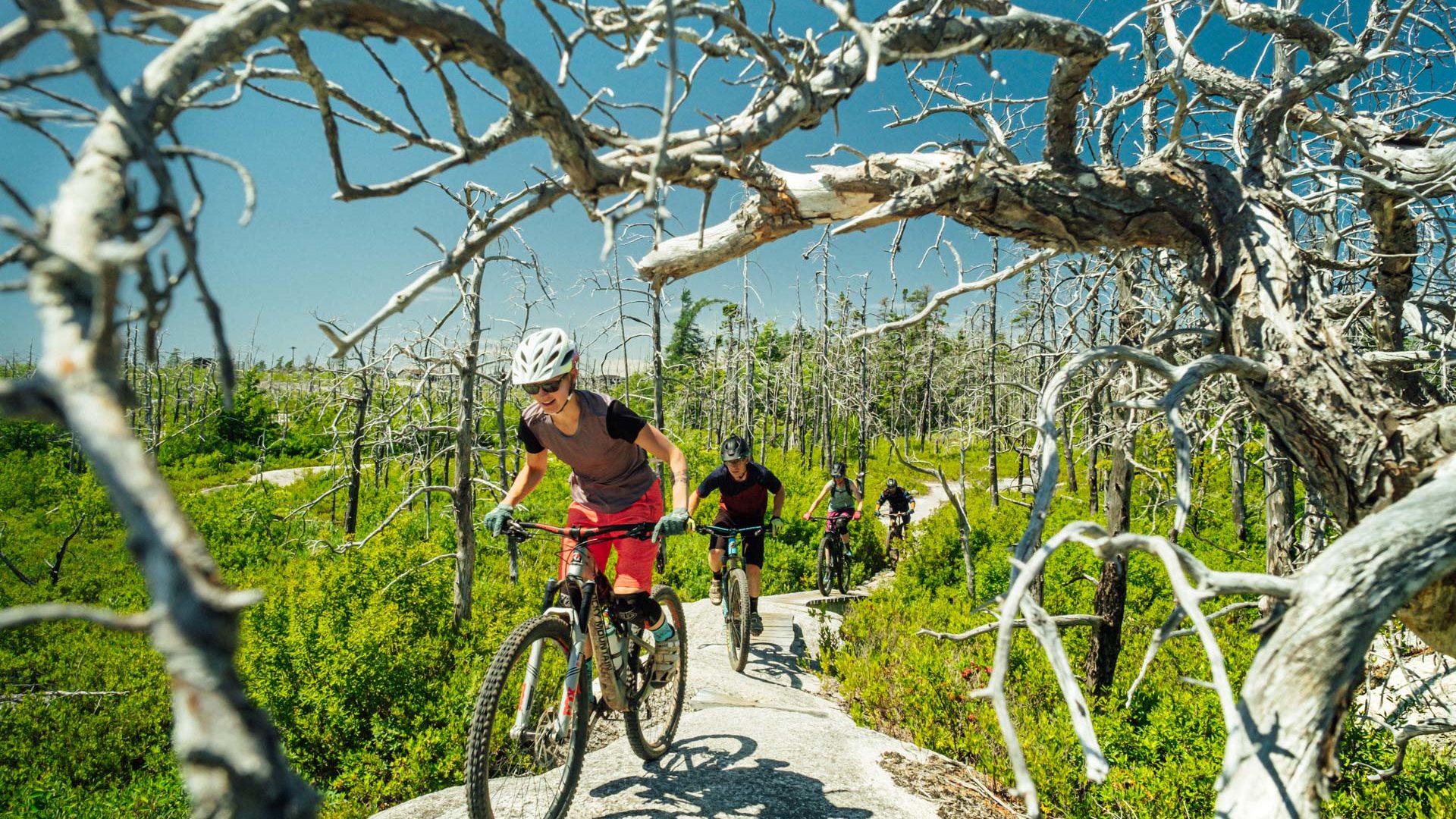

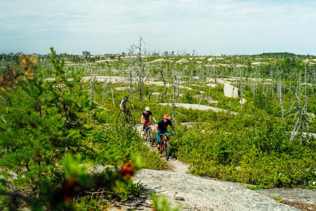
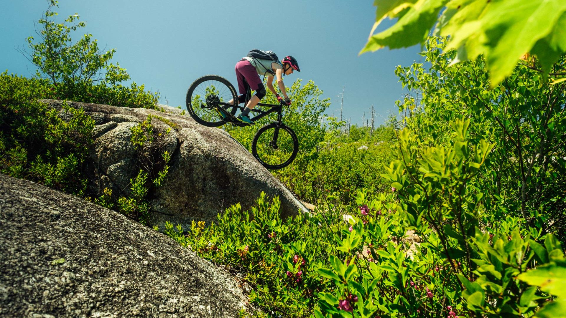
Granite rides at McIntosh Run, NS

Halifax, Nova Scotia
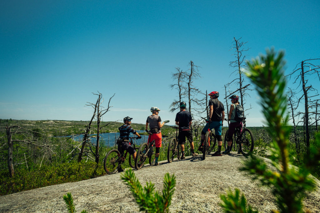
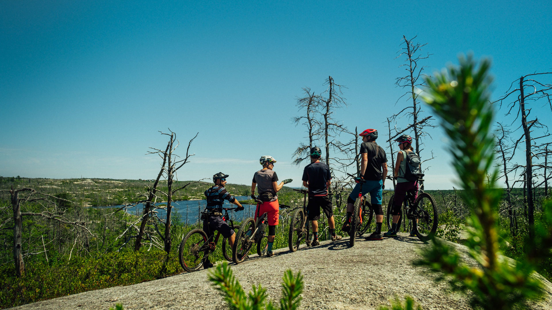
Lake views at McIntosh Run, NS


What to Expect:
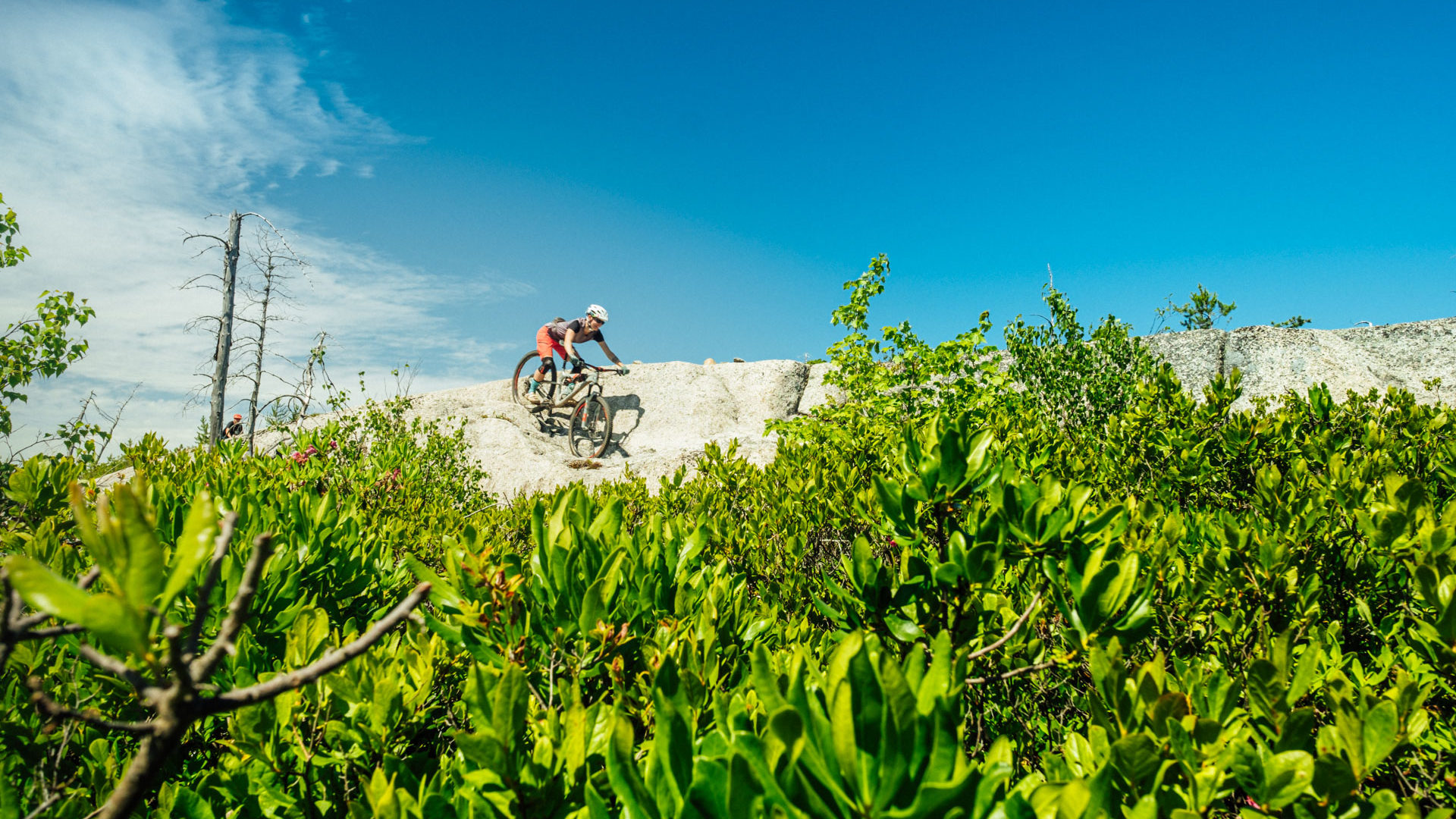
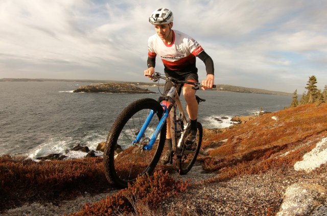
The McIntosh Run watershed hosts a unique trail experience combining grippy granite whalebacks, views to the ocean, challenging ledges and drops, and lush forest. The terrain is rolling — climbs are short but punchy. For years, trails here have been known to be some of the most challenging anywhere; that’s still the case, but increasingly there is something for almost anyone. This 20km system is evolving rapidly: Come back often and keep your Trailforks map at hand.
For
The forested southeastern region presently hosts the beginner level singletrack (In-N-Out, Nora and Warren). Trails here have more gradual climbs, wider bridges, but still plenty of smaller rock features and roots that help develop skills and keep things interesting. Access is from the Norawarren Trailhead in Herring Cove.
In the northwest, start with Divide, Osprey, the Attic trails, and find the flow of granite whalebacks, mixed with steep transitions and off-camber lines that will challenge most intermediate riders. Or head to the southeast area, and hold your speed in classic tight woods riding and optional spicy features on West Pine. A new trail (Fall 2019) will link the system with an epic trail combining a bit of everything –from granite slabs to diving through dirt berms.
Advanced riders will find challenging features especially in the northwest part of the trail system with its roll downs, ledges, drops and off-camber granite. Due to the variety and varying size of the drops, expert riders will be sure to find technical trail features that will put their skills to the test and help bring those skills to the next level.
- Difficulty:
-
-
- Trails:
- 25
- Entrances:
- 2 Get Directions
- Total Distance:
- 22 km
- Total Descent:
- 446 m
- Total Vertical:
- 60 m
- Trail & Community:
- Visit Website

Trail Map:
-
Northwest area, Spryfield
Trailheads are on Alabaster Way (Osprey and Divide trails) and Mica Crescent (Spar Trail). There is limited parking in the subdivision, so please consider parking outside the subdivision near Herring Cove Road, and riding in on the Community Trail or roads.
-
Southeast area, Herring Cove
Trailhead is on Norawarren Drive with on-street parking.
Bike friendly businesses close by:
-
Open Community Filters

-
Displaying:
9
Businesses
-
Reset Filtering & Search Results

Sorry - there are no results for these filters. Please try again.

Quest Carbon Cycles
All Quest Carbon Cycles bikes are made with Toray Carbon Fiber. Quests client concierge service allows clients to be part of the build giving them unrivaled customization in building their bikes. The unique direct to consumer model allows the bike to arrive right at your door.

Outdoor Elements Alma
Outdoor Elements is an outdoor adventure outfitter with locations in Sussex, Alma and Fundy National Park. We are a specialty ski shop in the winter months and a bike and outdoor retailer during the summer months. As the official adventure outfitter in Fundy National Park, we currently offer canoe, kayak and paddle board rentals at Bennett Lake and Mountain bike and fat bike rentals at the Chignecto Recreation Area.
Outdoor Elements Sussex
Outdoor Elements is an outdoor adventure outfitter with locations in Sussex, Alma and Fundy National Park. We are a specialty ski shop in the winter months and a bike and outdoor retailer during the summer months. As the official adventure outfitter in Fundy National Park, we currently offer canoe, kayak and paddle board rentals at Bennett Lake and Mountain bike and fat bike rentals at the Chignecto Recreation Area.

Meridian 63 MTB
Meridian63 MTB offers full-service mountain bike lessons and tours. Life is better on a mountain bike!
Shoreline Dirtworks
Shoreline Dirtworks designs, builds and maintains world class pump tracks, mountain bike parks and mountain bike trails.

Outer Limit Sports
Outer Limit Sports has been operating on PEI since 1994. Providing the best sales and service experience is our goal. We sell the best brands in the business. Offering full repair shop with fast service. Whether you are purchasing a new bike or renting a bike to see PEI, we are your one stop shop.

Keppoch Mountain
Positive Action for Keppoch is a charitable non-profit with a mission to provide outdoor recreational and educational opportunities for people of all ages. This is achieved through management of a professional-grade non-motorized trail system for mountain biking, hiking, and Nordic sports.

CycleSmith
Giving you the best service and selection has been Cyclesmith's focus since 1986 and has established us as the premier bike store in Halifax and Atlantic Canada. We offer the best brands in the industry, the largest selection of bikes, accessories and clothing, a complete full-service repair department, a bike fitting studio, and friendly and knowledgeable personnel.

Ride East
Based in Halifax, Nova Scotia, Ride East provides Mountain Bike adventures and instruction in Eastern Canada. Whether you’re a beginner or a seasoned veteran, our certified guides will match your ability and fitness to the proper terrain to provide you with an unforgettable mountain bike experience.
Recent Posts About McIntosh Run


Other trail networks close by:

M.A.R.C. Trails
Nova Scotia
Located in Dayspring just minutes away from Bridgewater. The singletrack trails feature a wide array of hand-built and machine-built options that have evolved over the past decade and continue to expand.

Wentworth
Nova Scotia
Wentworth is a 4 season destination where mountain bikes, hikers, cross-country skiers, trail-runners and nature enthusiasts meet.

Kejimkujik National Park and National Historic Site
Nova Scotia
Well-known for the canoe and portage routes traveled by the Mi’kmaq for thousands of years between the Bay of Fundy and the Atlantic Coast, a new addition to Kejimkujik in recent years are the multi-use trails that welcome mountain bikers!

River Ridge Common
Nova Scotia
River Ridge has a welcoming networking of wide, gravel surfaced trails suitable for riders of all abilities. River Ridge Common is a great pairing with Kejimkujik National Park.

Keppoch Mountain
Nova Scotia
Keppoch Mountain is a multi-use trail network in the highlands of Nova Scotia. Sprawling over 500 acres there are 45+ trails, 35+Km, 219m elevation with 183m vertical. There are wide gravel trails and a Skills Park suitable for families and cyclists of all ability.

The Railyard Mountain Bike Park
Nova Scotia
The Railyard Bike Park is a fantastic cross country mountain biking trail network located close to the center of Truro in the larger, Victoria Park. Riders can begin their ride with a long climb into the main riding area and finish with a descent back into the town center, or they can choose to skip the climb and start on the upper-level trails.

The Gorge
Nova Scotia
From smooth-rolling beginner trails to steep rooty, rocky terrain for advanced riders, The Gorge has it all. You’ll also find a fun skills park at the main entrance and many built-up free ride features on the trails for an added challenge.