
Club plein air de Caraquet, Caraquet NB


What to Expect:
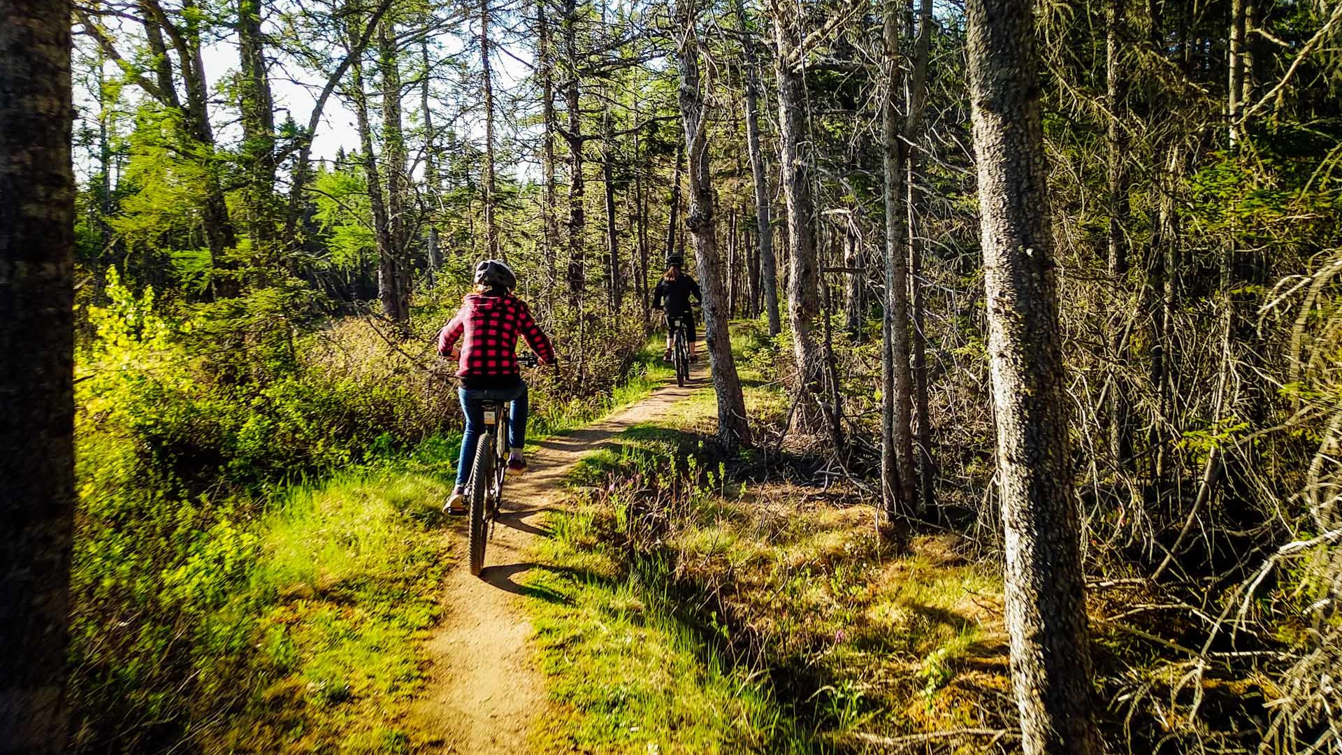
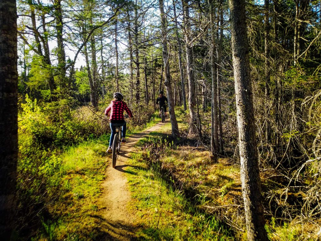
Located on land owned by the town of Caraquet, this playground offers mountain bike trails developed with the help of expert consultants to meet the IMBA standard. The trails are enhanced with many berms allowing cyclists to flow in the turns. Since there are few mountains in the region, we focused on the flow to ensure an enjoyable experience for all. All trails can be used in both directions. Bike rental is available on site during opening hours.
For
The beginner trails are identified with a green circle. They are built to allow a pleasant experience for the whole family. The bridges are wide, the slopes less abrupt and there are few obstacles. Those trails are also closer to the Club. Make noise in the Tintamarre or go on a hunt for the moose ghost in the Forêt noire, it’s guaranteed fun!
The intermediate trails are identified with a blue square. They have many berms and steeper slopes allowing a faster flow. Those trails are still accessible to all with a little vigilance. The popular Clairière is a signature trail with 5 consecutive berms in a scenery full of wild flowers.
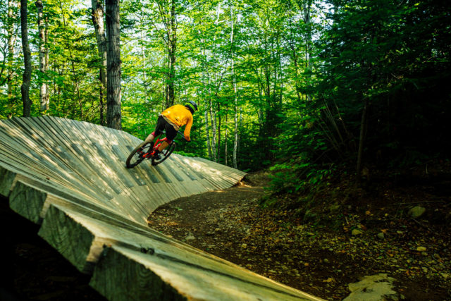
The expert trails are identified with a black diamond. The Crête is a loop along an old quarry with steep banks on each side in places. Some sections are really narrow and exposed and there is a dual slalom section with berms followed by table tops. The Cajun offers an agility course through wood and tire obstacles. This trail is accessible to all since obstacles have “chicken runs”. Are you up for the challenge?
- Difficulty:
-
-
- Trails:
- 12
- Entrances:
- 1 Get Directions
- Primary Trail Type:
- Cross Country
- Total Distance:
- 12 km
- Total Descent:
- 30 m
- Total Vertical:
- 30 m
- Trail & Community:
- Visit Website


Trail Map:
-
Club plein air de Caraquet
The trails starts behind the club (south side) on a ski trail then in about 200m, the MTB trail system entrance is on a 3m by 30m bridge. There is parking for about 50 cars in proximity of the Club.
Bike friendly businesses close by:
-
Open Community Filters

-
Displaying:
0
Businesses
-
Reset Filtering & Search Results

Sorry - there are no results for these filters. Please try again.
Recent Posts About Club plein air de Caraquet


Other trail networks close by:

Dieppe Rotary St-Anselme Park
New Brunswick
Dieppe Rotary St-Anselme Park offers a variety of short track laps that intersect a BMX track, playground, beer garden, and splash pad that makes this Park a great destination for all.

Poley Mountain Bike Park
New Brunswick
Located in the hills just outside downtown Sussex on the Fundy Trail, Poley Mountain is a lift-access mountain bike park.

French Fort Cove
New Brunswick
French Fort Cove in Miramichi is a popular trail network located in the hills rolling down to the Miramichi River.

APASOA Shediac
New Brunswick
The Association Plein Air Shediac/Shediac Outdoors Association Inc. (APASOA) builds and maintains non-motorized nature trails to be enjoyed for walking, hiking, trail running, snowshoeing, mountain biking, and fatbiking.

Becaguimec Trails Hartland
New Brunswick
Located in Hartland and named after the Wolastoqiyik (Maliseet) river that runs beside the trail network, the Becaguimec Trails aka "The Bec" offer a cross-country experience in Western NB.

Woolastook
New Brunswick
Woolastook is a former Provincial park with cross-country trails, tall forests, and rolling terrain along the water.

Sussex Trails
New Brunswick
Connecting Sussex and Sussex Corner, the Sussex Nature Trail is a scenic trail that follows Trout Creek.

Rockwood Park
New Brunswick
You can expect what is in the name - Rock and Wood! This old school trail network has plenty of technical challenges to offer every level of rider. This municipal park has ~40km of single track trail, so there is something for everyone to work on in Rockwood.

Sugarloaf Bike Park
New Brunswick
Sugarloaf Bike Park, designed by Whistler’s Gravity Logic, offers a thrill for riders of all abilities. Riders enjoy a scenic trip on the chairlift up the 505' mountain to the start of 10 Downhill trails and access to 10 Cross-Country trails. Trails consist of smooth, gentle cruisers, twisty single track and challenging old school rocky rooty black diamonds.

White Rock Recreational Area
New Brunswick
White Rock Recreational Area provides some challenging and varying terrain for mountain biking in Hillsborough, New Brunswick

Fundy National Park
New Brunswick
Fundy National Park is in the transition zone between the strictly coniferous boreal forest to the north and deciduous-dominated forest to the south. Fundy’s landscape offers trails that appeal to bicyclists of every level, from flat and forested trails for family outings to exciting ravines where you can challenge your friends.

Sentiers Madawaska Trails
New Brunswick
Just 2 minutes from downtown Edmundston, the Madawaska Trails network is real mountain terrain. 60 km of trails built according to IMBA specifications by passionate volunteers thanks to generous forest landowners.

Minto Trails
New Brunswick
Located on a swath of land that had been mined for coal as far back as 1639, ridges of mine tailings provide a playground with few rocks or roots to slow you down.

MFB Chaleur
New Brunswick
A fun and natural trail network that sits in the City watershed with many valleys throughout it. Elevation changes range below the 50m mark with approximately 15kms of single-track trails. Trails range in green, blue and black diamond with a gravel walking/biking trail that loops through the trail network.